Map - General
The Map Tab allows you to control mapping features on the platform.
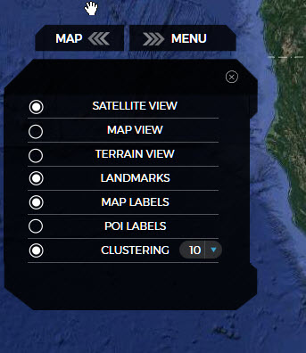
Selecting Satellite View/Map View/Terrain View will bring up those different types of map views.
Landmarks - Show/hide landmarks that were previously created in the portal.
Map Labels - Show/hide Google's default map labels.
POI Labels - Show/hide Google's default Point of Interest labels.
Clustering - Used to automatically group devices in an area. Helpful when you have many devices in an area. Putting your mouse over the clustered area - will show in a pop-up window, all vehicles within that area.
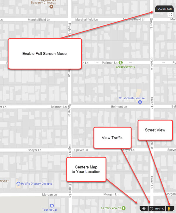
Additional features found on the user interface:
Marker Pin:
Dragging and dropping the marker pin to any area on the map, will display the Map Marker Menu.
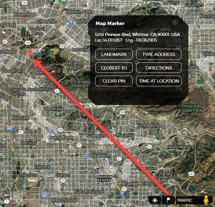
- LANDMARK - Creates a Landmark from where Marker Pin Was Dropped.
- CLOSEST TO - Get The Locations/Travel Time ETA for Devices Closest to Dropped Pin.
- CLEAR PIN -Clears The Marker Pin.
- TYPE ADDRESS - Set The Marker Pin to a specified Address.
- DIRECTIONS - Send Directions to a Marker Pin to any Cellphone/Email address.
- TIME AT LOCATION - Quickly Find If/When any device has been at a specified Marker Pin Location.